DRONE FLIGHTS
We performed a preliminary ground truth survey to identify and geographically tag invasive and native plant species throughout Panofsky Field. Before each drone flight, we placed marker signs next to the target plants. After the maps were created from the drone images, we created a finalized groundtruth data set using the signs, geographic tags, and visual inspection of the imagery to pinpoint individual plant targets. The image below is an aerial view of the 20-acre Panofsky Field site. It was assembled from over 1000 individual images taken from 120 feet.
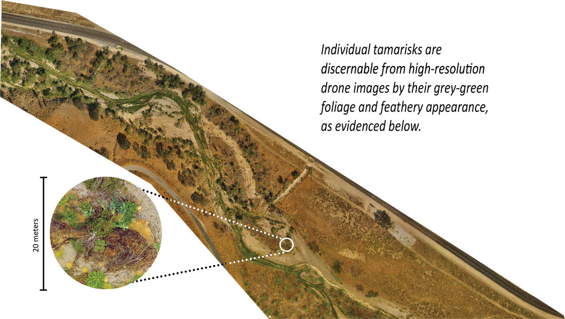
IMAGE CLASSIFICATION
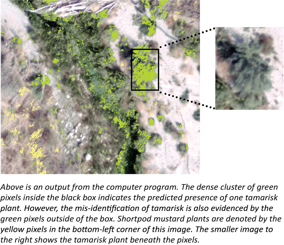
We confirmed it is possible to visually identify tamarisk through the drone images, but we were also interested in automating this process to save the Conservancy staff’s time. To do this, we used ArcGIS to run an image classification program, in which the program inputs were the marked tamarisks from the ground truth survey. The program referenced visual characteristics, specifically, the relative amounts of red, green, and blue reflected light emitted by each plant, in order to identify other plants in the image that were not marked in the ground truth survey. While the program had moderately high accuracy, it also incorrectly identified several plants as tamarisk. Despite these errors, we observed more accurate identification of shortpod mustard, another invasive plant of concern to the Conservancy. With some fine-tuning, this program could be trained to become more accurate, and thus a powerful tool for analyzing drone-acquired images.