MAXENTDue to the sheer size of Tejon Ranch, it was impractical to fly over the entire property. Therefore, MaxEnt, a species distribution computer program, was used to identify areas with high risk of tamarisk invasion. Inputs to the model included known locations of tamarisk and environmental variables such as slope, precipitation, and temperature. One of the vulnerable locations included Caliente Creek, where a 20-acre site called Panofsky Field was selected for test flights.
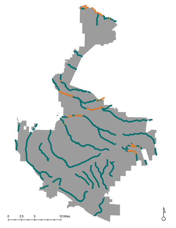
To the right is our output from the MaxEnt model. Major streams on the Ranch are highlighted in teal, and the highly vulnerable regions are highlighted along those streams in orange. Panofsky Field is located at the Northernmost region of the property.
|
|
